|
|
Post by akstafford on Sept 29, 2006 16:59:18 GMT -9
Does anyone have any experience using the Mapsource Topo in Alaska. Is it good? Is there something better?
|
|
powmia
Silver Cacher
 Caches Found/Hidden xxxx/x
Posts: 208
|
Post by powmia on Sept 29, 2006 18:54:12 GMT -9
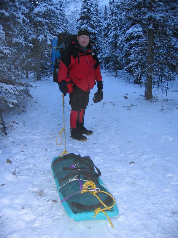
I use map source for all my GOcaches. I download directly from the Garmin GPS device to the program, then print the maps. I came print an overview of all caches in a particular area, or zoom in and get the street names/intersections for the individual caches. I can also save my maps to reference when I think a new cache is in an area I've been before, and want to refresh my memory. I can also cut/paste caches to update a map, or delete caches on a map I don't want. I can also measure distances in feet between parking spots and the cache. There are a bunch of uses for the program. I believe it is the only one that will work w/Garmin. I have a National Geographic program, but I don't use it for caching.
|
|
|
|
Post by Forum Admin on Sept 29, 2006 19:18:48 GMT -9
I use map source for all my GOcaches. I download directly from the Garmin GPS device to the program, then print the maps. I came print an overview of all caches in a particular area, or zoom in and get the street names/intersections for the individual caches. I can also save my maps to reference when I think a new cache is in an area I've been before, and want to refresh my memory. I can also cut/paste caches to update a map, or delete caches on a map I don't want. I can also measure distances in feet between parking spots and the cache. There are a bunch of uses for the program. I believe it is the only one that will work w/Garmin. I have a National Geographic program, but I don't use it for caching. I also use Map Source. It is a very good program! |
|
|
|
Post by New Yorker on Sept 29, 2006 19:29:20 GMT -9
Does anyone have any experience using the Mapsource Topo in Alaska. Is it good? Is there something better? Mapsource Topo is very useful for us in city, mountain, forest, and desert caching. It identifies city streets, parks, rivers, lakes, moutain peaks, elevations, shipwrecks and many more. Just visit www.garmin.com/cartography/ for more details. An excellent addition to a garmin gps. 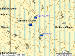 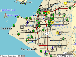 |
|
|
|
Post by NorthWes on Oct 6, 2006 11:58:28 GMT -9
I can't get the Garmin Cartography link to completely load.  New Yorker - do you have a smaller-scale screen shot of the Topo? The one posted is at 2 miles. I'd like to put this on my Christmas want list if it looks good at say 500 feet... |
|
|
|
Post by New Yorker on Oct 6, 2006 19:02:25 GMT -9
I can't get the Garmin Cartography link to completely load. New Yorker - do you have a smaller-scale screen shot of the Topo? The one posted is at 2 miles. I'd like to put this on my Christmas want list if it looks good at say 500 feet... Here's what I got from MapSource Map Viewer which is exactly what my Mapsource Topo Program displays. 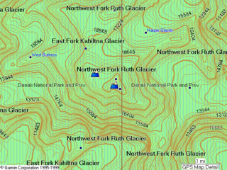 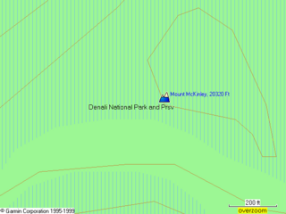 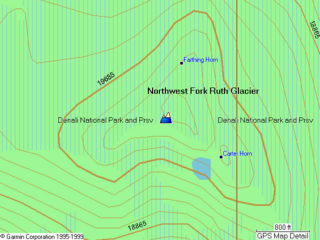 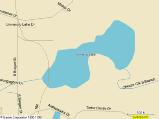 |
|