|
|
Post by Malcore on Aug 8, 2007 18:13:08 GMT -9
I was just thinking about the database that Geocaching.com uses for there benchmarks and was wondering how often they update it. If they do at all. The reason I ask is I was caching down by Hope with FrostG1ant and OMGCrew last weekend and while we were going after 'Corgi Flyer' and 'Lucky strike II' we found this benchmark and saw two others in the distance.  As you can see it is Farly new and I was curious if they would ever have a chance of being added to the benchmark database. |
|
|
|
Post by NorthWes on Aug 9, 2007 7:41:16 GMT -9
Your question is a topic on the gc.com benchmarking forum. Best answer to date is 'It's a long ways off'... which means to me 'don't even think about holding your breath.'
As to this particular benchmark, it will never make the NGS database we draw from in any case as it's a 'cadastral' mark, meaning it was used primarily to set property boundaries rather than a specific 3D location tied into the master national geodetic database. The (supposed) high order of accuracy tied-in geodetic control points which we hunt in the gc.com database are expensive to set up; they're not always as accurate as the newly-set GPS cadastral survey markers, but they're tied-in to that national network...
Most federal land management surveys will stamp the face of the marker 'cadastral' to indicate its status (as in this case). Now, just to prove the point that every rule has an exception, I have found marks clearly stamped 'cadastral' which have been brought into the national geodetic database. A local example doesn't leap right to mind, but I've found them in the southwest US.
If you've ever used the waymarking.com website, there's an extensive collection of these cadastral benchmarks listed there. You can always log them in like that!
|
|
|
|
Post by oleruns on Aug 11, 2007 20:08:01 GMT -9
So I found these two next to Hanging Lake Cache N 61 12.069 W 149 21.661 The other was just down the trail a bit. They both have "CADASTRAL" On them and not listed in the database like Malcore's, correct? Is it worth logging them like your reply to Malcore? - What would NorthWes do if he ran across these??? 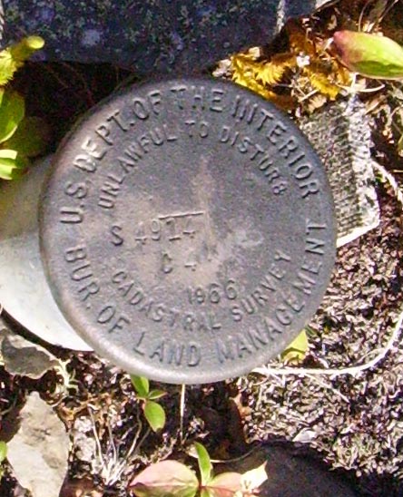 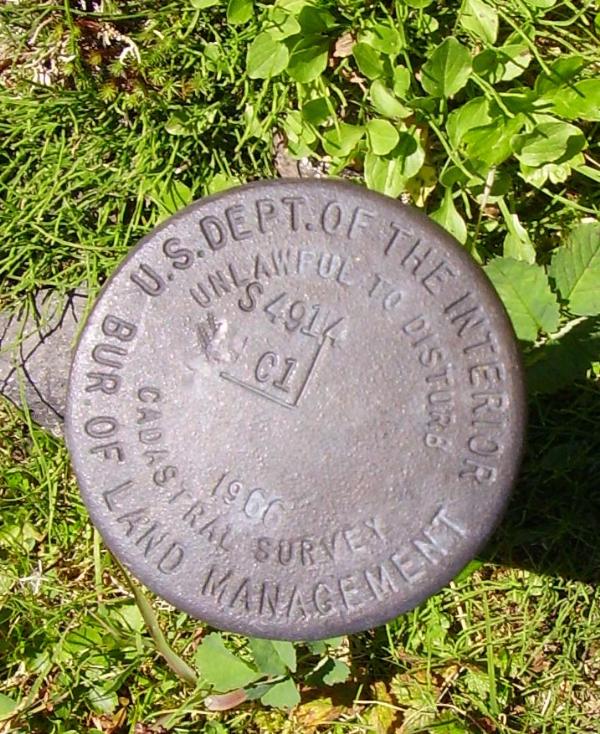 |
|
|
|
Post by NorthWes on Aug 14, 2007 8:32:52 GMT -9
NorthWes would be feeling pretty good about himself for getting all the way up to 3350' of elevation! I'm sure the scenery up there's awesome - I haven't been that far up South Fork. Sharp eye for finding these, Oleruns... but I suppose they stick out a bit above timberline, eh?
In any case, those are cadastral survey marks related to the land transfers back in the Sixties that helped establish Chugach State Park, among other things. They're only loggable on the waymarking.com site; not listed on the wider NGS database. *sigh*
|
|


 - - - - - - - - -